Thursday, 26 July 2018

Training walk - 23 July 2018

Villages to the East of Wantage circular– Monday 23 July 2018

This walk starting and ending in Wantage was designed as a fill-in. We needed to find somewhere that was accessible without using Oxford station as there was a two-week blockade in operation. Strictly the trains were operating again on the date of the walk but by then the plan was in action. P was unable to join us. A and N arrived from Oxford (S9 bus) into Wantage market place at 10:30 and T arrived on a Thames Travel bus from Didcot a few minutes later.


Cottage (?) East Lockinge
It was already hot (approx. 25C), so we set off without delay though the back streets of Wantage, past Eagles Close Almshouses (Grid Reference SU3997 8781). The first part of the walk was out along the Charlton Road heading east and then turning up Larkhill to pick up the bridleway (well used cycle path) to Lockinge. Our plan for the day was to walk through the small villages of Lockinge (West and East), the Ginges (West and East), the Hendreds (West and East) and then back to Wantage via Ardington. In view of the heat we decided to keep East Hendred for another day.

T had promised plenty of pubs but had spotted from the bus that the Plough in East Hendred (an old favourite from 40 years ago) and the Hare at West Hendred were now closed. Never mind we should be able to find somewhere in Wantage on our return.

Best Mate
Luckily our walk was mainly along quiet wooded lanes through the villages. The sun was beating down and the breeze, though welcome, was warm. Later on N described it more as a blast from a paint stripper!
The Lockinges are known for horse race training. On the village green in East Lockinge is a statute to Best Mate who won the Cheltenham Gold Cup in 2002, 2003 and 2004 for his trainer Henrietta Knight who was based in Lockinge (SU 4248 8739). The villages of E & W Lockinge were smart, well-manicured and typical of the Berkshire Downs area (even though we were in Oxfordshire). Several of the fields (paddocks) were occupied by flighty looking race horses.
We are not race horses though

This walk was an opportunity to catch up on family news and to discuss things like the World Cup and recent excursions and family parties in London and Bath. Before we forget, congratulations to E, N’s daughter, who had just graduated.
We stopped to admire the pretty church of All Saints at East Lockinge next to the Lockinge Brook which was slowly flowing northwards, presumably spring-fed.
All Saints, East Lockinge


Betterton Rhino 
Further on we passed Betterton House and grounds and were surprised to see a rhino statue in the grass by the brook – now known as the Betterton Brook (it is the same stream just changes its name as it passes through each village/hamlet.) The lane continued, and we arrived in the hamlet of Ginge. Yes it is divided into West and East by of course another chalk brook this one was known as (wait for it) the Ginge Brook! Here we turned off the tarmac onto a proper footpath to head northwards to West Hendred.  


We were following a variation of Walk #10 in “Walking in the Thames Valley” by Steve Davison published by Cicerone. The subtitle of the guide is “Adventurous Walking Routes”!
Overgrown footpath at SU4452 8712
To call this path a footpath is a joke. The path was just about discernible through 2m high stinging nettles, brambles, blackthorn and other stinging, scratching and pollen producing wild vegetation. Bear in mind it was about 12:30 on a hot and dry summer’s day and we were thirsty and tired and N & A were wearing shorts! 
Well after struggling for about 500m we decided to abandon the “path” and head up slope to take advantage of a shady hedge (SU4452 8712) to have a snack and a drink of water.


... and at SU4453 8677


A suggested that we crawl through the hedge and take a different route. Good idea - we emerged into a recently cropped hay field and carried on northwards towards the Icknield Way. Right, do we continue with "The Path to West Hendred" or divert on the Icknield Way and then a lane into West Hendred? No contest we took the latter route. We have to admit that this was the first rough, overgrown path we had come across for some time. Surprising as it was the route recommended in the booklet.

Holy Trinity, West Hendred
We were glad of the “welcome” bench in the churchyard of Holy Trinity at West Hendred. We took time to sit in the shade and finish of our snacks. T investigated a couple of WWI war graves in the churchyard, one from 1917 and the other from 1915. Both stood erect among all the other grave stones that were all tilted at some severe angle or overgrown in long brown grass and ivy.

Ardington House


Ardington Brook
Luckily the path on the way back was good and fairly busy, several other pedestrians (not really walkers) and cyclists. But gosh was it hot. We picked up some shade as we passed Ardington House (according to its website a Georgian House available for a range of events including weddings).

Our path took us through the estate buildings which have now been converted into offices for trendy hi-tech businesses and back westwards to West Lockinge.


We re-joined the path back to Wantage and after nearly 2.5 km were back into the town.


Excellent, the “Shoulder of Mutton” was open. What a relief and an opportunity to freshen up in the loo and have a much needed drink of three to quench our thirsts. We were last here on 17 April 2014 while doing the Seven Shires Way). It must score at least 8 moving towards 9 out of 10. Refreshed we headed back to the Market place for our respective buses home.

Impressive we managed 8.4 miles (13.4km) despite the heat and “jungle path”. Charming countryside and villages. No operational pubs or shops but interesting statues and lovely places to live so long as you have a vehicle.

Tuesday, 17 July 2018

Training walks (Spring / Summer 2018)


Already into the second half of 2018 and not much to report. Progress on the Cotswold Way has been put on hold until we can find a block of time to get several sections completed. Therefore, we have resorted to undertaking some local walks around the Oxford and Reading area. These are summarised below with what memories and photographs we have.

Hailey circular walk – Monday 28 May 2018


Towards Well Place
Our starting point was Hailey a hamlet in the Chilterns to the south-east of Wallingford, Grid Reference SU 6425 8586. It is well known in our circle as it is home of the King William IV pub (http://www.kingwilliamhailey.co.uk/). Many years ago, we used to journey out to this delightful “watering hole” on the occasional lunchtime from work, which was only 5km away. It was also an impressive spot to take overseas visitors to, to give them great views of the Chilterns and good beer. In those far-off days (we are talking 30 years ago) the only food on offer was a selection of home-made filled baps. These days there is a much wider selection on the menu. The view hasn't changed.

T remembered that it was where he had his “stag” party though P who was also there didn't recall it.  I can assure our readers that our hazy memories are due to passage of the years and not to the effects of drink then nor now.

We agreed to meet up at lunchtime, take in a snack and a drink before heading off on a short walk planned by P. As it was a Bank Holiday public transport wasn't too clever, so A gave N & P a lift. T was able to get a Thames Travel bus (now marketed as River Rapids) to the main A4075 near Ipsden and walked nearly 2km to the pub. T arrived first and managed to bag an outside table.

It was great for the four of us to meet up again and swop stories and news. A had got back the day before from France and N was just back from or about to go to the Caribbean on business. Discussion of “the wedding” (Harry and Megan) was frowned upon.

Chiltern view
After a pleasant hour or so we reluctantly agreed that our main purpose was to walk so we headed up the track past Hill Farm and then down the field towards Well Place. Well Place Farm (SU 6474 8527) used to be a zoo specialising in Pheasants and small mammals. It closed many years ago but was a useful place to bring young children to experience a zoo without great expense.  Our path then followed what is known as Urquhart Lane past the entrance to Handsmooth (SU 6547 8540). P & T had walked this path before on 23 September 2016, though this time P had walking boots on.


Homer farm
Our route turned north through the woods to climb up past Handsmooth (believed to be the country residence of Rowan Atkinson). It was good to be in the woods as it was turning into quite a warm afternoon. We emerged at Homer, another Chiltern hamlet, and went past an art studio, (SU 6628 8577). T recalled visiting this place, several years ago, during the Oxfordshire Arts Weeks event. There was a welcome breeze as we crossed the fields and joined the path / farm track past Upper House Farm to descend through the lovely mixed woodland of Mongewell Woods.

Unusually for us we meet quite a few people out for an afternoon walk in the glorious sunny and warm weather (little did we all know that this hot sunny weather was to continue through June and well into July). Out into the sunshine again and down to Woodhouse Farm (SU 6406 8718) where we turned south towards Hailey and back to the pub, which we knew as the King Willy or Billy* and a drink to quench our thirst. We can confirm that our designated driver, A, did not have an alcoholic drink at this time.

* Note the pub is named after the last of the “Georgian” kings. We are sure that Wikipedia has lots to say about him. He was brother to George IV, interested in naval matters, there is a big dock in Plymouth named after him, hence one of his nicknames “Sailor Bill”.

A was able to give T a lift back into Wallingford to catch the X40, on the way to return P & N to their respective homes.

Spring flowers
A very nice afternoon ramble of 4.8 miles (7.7km). OK not that far but far enough on such a warm afternoon.


Binfield Heath circular walk – Friday 15 June 2018


Our next walk was planned by T and was based on Ramble 2 in “Rambling for Pleasure around Reading”. This is described in the booklet as a “circular walk through peaceful, pleasant farmland and woodland to the west of Shiplake”. There were just the two of us, T & P.  We met up at the Sonning Common base and drove out to Binfield Heath. We parked on Arch Hill near the Recreation Ground, SU 7463 7859. (Note: there is safer parking in the Recreation Ground parking area) and followed a path towards Kiln lane.

Fields of Barley, Binfield Heath
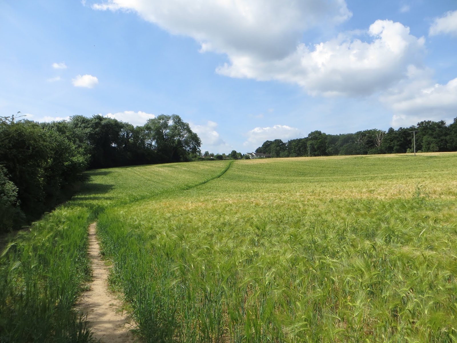
A pleasant sunny morning and as usual we were surprised at how quickly we moved from a village lane and its now gentrified cottages to crossing a field of barley and apparently in the middle of the countryside. In fact, we were only 4km from the centre of Henley-on-Thames (as the Red Kite flies).


High wood
The path descended a gentle slope and then climbed up to High Wood. The trees offered some welcome shade from the hot sun. The path then passed what looked like a construction site but was in fact an archaeological dig site. This was a South Oxfordshire Archaeological Society (SOAG) dig of a late iron age farm house or farm building. There was a notice board nearby explaining that most of the finds had been robbed-out many years ago and that all was left was some roof debris and wall structures. It was difficult to identify the site from satellite pictures, but the approximate location is at SU 752 796.

Roots of civilization?

At the edge of the woods we turned right to go past Ash Farm in Upper Bolney. Ash Farm appeared to have converted into posh dwellings. There was certainly no farming going on.


SOAG noticeboard


Our route took us eastwards and then turned south (SU 7617 7982) to go across a field of linseed (flax). Ine mid June it was not in flower but a fortnight later T returned with Cy and found a field of blue matching the sky above. Towards the end of the field were a couple of people with a working cocker spaniel that was being trained by its owner. We spent a few minutes talking to them while the dog had a drink of water. Afterwards we wondered what their story was. Was the dog being trained for security duties? The supervisor didn't seem to be the owner and appeared to be training the owner as much as the dog.


Can you see the North Downs?
Back into Shiplake Woods and eventually out on to Kiln Lane and then Shiplake Row (SU 7586 7858). Opposite Orwell's Restaurant (previously a pub) there were some attractive old cottages and a modern dwelling of shiny metal and glass. We missed the path and had to backtrack to the restaurant and follow the path across a wheat field. There was a view to the south and we guessed it was the North Downs that were on the southern horizon. It was getting hot, so we were glad to move into the woods of Shiplake Copse and then eventually to join the road into Binfield Heath at SU 7436 7815.

Way thru the crops
It was a short walk back to car and a return to Sonning Common for a cuppa.

A very manageable two hour walk of 4.1 miles (6.6 km). The description in the booklet was accurate and T was so impressed that he and Cy did the walk again a fortnight later.

Friday, 18 May 2018

Cotswold Way : Stage 1


Bath to Lansdown  - Monday 9 April 2018

Bath Abbey
Here we are again on the “usual” train from Didcot (d. 09:40) to Bath Spa. We didn’t manage to find the time or a reasonable patch of weather in March to undertake another ”Training” walk so we opted at fairly short notice to get started on the Cotswold Way to return northwards to Chipping Campden and eventually to Banbury.

We are following the Cotswold Way which is a fairly well defined path with clear waymarks and a  guide book “Walking the Cotswold Way” by Kev Reynolds published by Cicerone. The path is described in both directions which is helpful as we discovered that we are doing the walk the less fashionable way, south to north. No matter the prevailing wind should be behind us for most of the way.

We (all four of us; P, N, A and T) set off through the streets of Bath and declared the beginning of the walk outside Bath Abbey, next to the Roman Baths. The weather could have been warmer though the rain held off. It was a Monday morning but the streets were quite busy with shoppers and tourists. Bath we guess is one of those 365-days a year destination. We zig-zagged through the streets, passing the Jane Austen Centre and a posh hotel that N and wife were planning to stay in. Up to the Circus and along to the Royal Crescent. Further on was a fairground packing up to move onto the next venue and we had to weave through their massive trucks. It was interesting to see the backs of the Georgian Terraces which contrasts greatly with the “Bath stone” fronts.
The Royal Crescent, Bath

Climbing all the time up what we later found out was Primrose Hill we passed the water treatment works and came out in the suburb of Weston. Up another hill, sorry P, we eventually left the built up area and started out into the countryside and towards Kelston Round Hill.

Conversations varied between catching up on N’s business travel, getting updates on respective children and their employment or studies. Actually we didn’t have much breath for chatting as the path climbed steadily. We had started out at about 20m above sea level and were now approaching 200 m ASL. It was time for a break but where to stop? 

"Useful Bench", Prospect Stile
We came to “useful” bench and a reasonable view at Prospect Stile, Grid Reference ST7131 6831. S we took the chance of a sit-down to eat our respective packed lunches with a view back the way we had come (climbed) past Kelston Round Hill.
Back towards Kelston Round Hill


We were on the edge of Bath Racecourse. The path skirted the western edge of the course and then dropped down and around to Lansdown Golf Course. Some other walkers passed us heading to Bath in a very determined way with major back-packs and walking poles. We expect to see more walkers on our travels along the Cotswold Way as this is one of the well-known walks. Compare this to the Seven Shires Way of a few years ago when we rarely saw anyone and often had difficulty in finding the path!

Sculptures in the rain
David Michael Morse (1942-2016)
It started to rain – that’s why those walkers were so determined. It wasn’t too wet and by now the path had levelled out. We came across some interesting metal sculptures in a field beside the path.
The nearby information board told us these were by the late David Michael Morse (1942-2016) but we have not been able to find out anything more about him.

Information: Battle of Lansdown
We were getting tired and by the time we reached the site of the Battle of Lansdown(e) (English Civil War) 5th July 1643, we decided that it was time to return to Bath. We headed past the communications buildings of the Avon and Somerset Fire Service and across the main road into Bath. We were just planning to phone for a taxi when A spotted a taxi heading towards Bath. Quick action by A got the chap to stop and we were soon heading back into town, after suitable precautions had been taken by the driver to prevent too much mud from our boots messing up his taxi.

It turned out that he was a local chap and was interested in our modest walking exploits. He was also a Bath Rugby fan, but we won’t hold that against him. We explained our desire for a friendly, unpretentious pub. No problem. He took us to The Salamander on John Street an excellent pub, Bath Ales (though now taken over by St Austell). Certainly, we can give it an 8 out of 10 perhaps 9 out of 10 when we get to know it - excellent  place, warm, and simple décor. We (P, N & T) sampled a few beers, nothing excessive, and liked “Prophecy”. A prefers lager. Then it was time to find the station and the train home. Somehow we headed off in the wrong direction but eventually found the station by heading downhill towards the river. 
Hopefully we were in better shape than this guy
Our first stage of the Cotswold Way was 7.2 miles (11.6km). Not bad as we were all (lets be kind) out of practice. It was good to be walking again. Hopefully we can press on in the next few months as days lengthen and the temperatures go up.

Thursday, 17 May 2018

Training Walk: Theale to Pangbourne - 26 February 2018


Well dear readers we made a good start on 22 January with completion of our own invention of Route 66 from Wheatley (Oxford) to Faringdon so the plan was to continue with what we term “training” walks with a local (of sorts) walk from Theale to Panbourne. N was unable to join us as he was away on business in some sunny clime though he assures us that this is usually a basement meeting room in a hotel and he never sees the sun or breathes fresh air. It’s a tough life!

The result was that P, A and T agreed to meet outside the Three Guineas pub by Reading Station and take a JetBlack bus out to Theale.

It was a sunny but cold day. This was just before the much publicised “Beast from the East”. A few cold days with some snow and frost which has been used ever since to account for the economic stutters that the British economy suffered. The weather forecast was correct and it was a lovely day for a winter walk so long as one stayed out of the brisk easterly wind. Apologies in advance, T forgot his camera so the only picture we have is from a phone.

The bus dropped us off in the middle of Theale, grid reference SU6422 7127 and we headed north out of the village towards the hamlet of North Street. The traffic noise from the nearby M4 was ever present which must make “country living” slightly less desirable.

We crossed the motorway by a footbridge (SU6412 7297) which added a few hundred metres to the walk as the pathway spirals up and then down to the over bridge. We carried on eastwards, through a plantation and out into open fields with a splendid view of Sulham Woods. Suddenly quite quiet as the motorway was now downwind

Sulham Wood from SU6452 7322

Plodded up through the wooded slope of Beal’s Copse towards Little Heath Road, SU6542 7317. This is on the edge of Tilehurst, but this is the part that is in West Berkshire even though it is served by Reading Buses number 33!

We turned north and turned off along a very muddy path towards Sulham Woods and past the site of Sadler’s Farm, SU6494 7418). There were splendid views and countryside even though we were on the outskirts of Reading/Tilehurst. We crossed over the lane towards Sulham village and with a detour across an open field joined the path that P & T had followed last year, 12 April 2017. The easterly wind was certainly cold so we were eager to find a sheltered spot in Sulham Wood for our packed lunches. A convenient log or tree stump was found in a relatively sheltered spot with some sunshine, SU64477528.

The path then headed downslope again and across the water meadows and adjacent allotments and through the Horseshoe Industrial estate to the Reading Road in Pangbourne, SU6378 7646. It was time for a warm drink . We headed into the Costa Coffee in Pangbourne and had a welcome coffee/tea before walking to the station for our respective trains to Didcot/Oxford or Reading.
.
We managed 5.4 miles, though it was never meant to be more than a way to keep on walking. A really nice walk and surprisingly hilly (as P commented several times). Perhaps something that could be repeated when it is not so cold or muddy.  Sorry about the lack of pictures. Your author attempted to go out there again (on the 33) in March but was not prepared for the muddy paths off of Little Heath Road. Perhaps we will edit this post in the future with additional photography. Though keen readers could look back at the Pangbourne entry in April 2017! Right let’s now press on to the Cotswold Way.