Thursday, 3 November 2016

Training walks - late Summer 2016


A fine day on the Chiltern scarp

Well the weather has remained fine so with N still away on a Caribbean jaunt (sorry, business trip) we (P & T) continued our circular walks in South Oxfordshire. Here are a couple of walks for the album.

As on previous outings we used the description and route given in Oxfordshire Country Walks – South Chilterns and Thames by Mary Webb, Alan Spicer and Allister Smith for the Stoke Row walk.


Stoke Row – Friday 23 September 2016

Maharajah's Well
T met P in Sonning Common and headed to Stoke Row and parked in the Village Hall car park opposite the Maharajah’s Well (Grid reference SU6796 8407 ). More details about this OTT well can be found at http://www.stokerow.net/well1b.asp

After having a look at the well and taking pictures we headed away from the village into the beech woods towards Checkendon to join Judges Road in Ipsden Wood. In the Spring this is a great place for bluebells. It was really quite a warm day so the shade of the woods was welcome. Lucky for P it was also dry as he had forgotten his walking boots! His shoes were fairly stout and there were no complaints. About a week earlier there had been quite a cloud-burst and thunder storm and we were to see evidence all day of eroded pathways and gravel fans across the country lanes.

Woodland - near Berins Hill
The path crossed the Stoke Row to Checkendon road towards Scot’s Farm and headed through woods sporting some magnificent tall trees. The path was well marked, someone in the past has carefully waymarked the paths with strategically placed white arrows painted on robust tree trunks. We climbed up to Garson’s Lane, past the farm of the same name.


The woodland path was starting to descend the scarp slope of the Chilterns. The woodland stopped and we were treated to a great view at SU6505 8476 looking westwards towards Ipsden and Hailey (well known for the King William IV pub (known as the King Willy or Billy).

Towards Hailey
We dropped down to Warrens Chase and then headed back up hill by way of an ancient hollow way before turning northwards again to Wellplace Farm. Years ago there used to be a small zoo near here specialising in pheasants.


The track way then headed eastwards to slowly climb back up the Chiltern scarp slope towards Ipsden Heath.


Handsmooth
The view uphill is dominated by the new development at Handsmooth, (SU6569 8557). 

The Mail Online referred to this on 22 February 2016 as (quote) Rowan Atkinson's Oxfordshire mansion is finally taking shape after a decade-long planning row with neighbours. “Mr Bean” star has finally completed his dream home dubbed a 'space age petrol station' due to its unique exterior (unquote).

The views from the spot must be great and one can see why it was chosen. The structure has yet to blend into the Chiltern landscape and as we found on the following walk it is all too easy to see from a distance!

As we emerged onto the minor road in Ipsden Heath there was plenty of evidence in the form of erosion and sediment from the runoff from the recent torrential rain.

Hundridge (Waste) Farm
The path then followed a track past Hundridge Farm, south-east towards Cox’s lane and Stoke Row. The book makes no mention of the mess around Hundridge Farm (SU6687 8548), old skips full of waste that had obviously been there for many years but concentrates upon fairy circles!

This is supposed to be a registered waste transfer site with regular visits from compliance officers from South Oxfordshire. How anyone can justify storing many tens of skips full of old building waste in the countryside, next to a public footpath for many years is beyond us. An environmental disgrace and obviously financial madness.

The countryside finally improved as we neared Stoke Row. Time for some packed lunch and then back to the village and return home via a welcome cup of tea in Sonning Common. A walk of 5.5 miles (just as the book said).

Lovely woods and an unexpected view marred to some extent by a challenging house and the waste land of Hundridge farm.

Above Warrens Chase (SU6505 8476)

South Stoke – Friday 14 October 2016

It was obviously time for another walk in the South Oxfordshire countryside. T had woken early one morning having a nightmare about Logical Frameworks! It was P’s turn to plan, met up at his home and drove to South Stoke, (Grid reference SU5983 8363). We were joined by a guest walker, known by the name of Rascal (R is a small dog belonging to a friend of P’s.) We started late at 11:30 as P had a barbers appointment earlier in the day.

View from Watch Folly
The day started misty but it was dry. Definite feel of autumn in the air and the leaves on the trees were starting to turn colour. We started from the centre of the village (we were last here on the Ridgeway walk #7 in December 2009). Headed east under the railway, over the B4009 (Wallingford to Goring road) and out along the Woodcote Road stepping aside several times for the large tractors and trailers of an agricultural contractor harvesting maize. We then headed NE below White Hill. Rascal was able to come off the lead as we took a straight path towards Watch Folly. T noted that this marked footpath was not on his OS Explorer map 171. (Time to invest in a new map perhaps?) At the top of Watch Folly (SU6205 8457)  there is some shelter so this was an obvious place to stop and have a late lunch break and take in the nearly 360 degree view. We could clearly see Rowan Atkinson’s Handsmooth House (see walk on 23 September 2016).
Can still see Handsmooth

The plan was to continue in roughly the same direction towards Larkstoke and then back via North Stoke. Both of us were feeling weary so we opted to head west towards Little Stoke. As we crossed the B4009 again the contrast from open chalk land with big fields to the smaller hedged fields nearer the river Thames was very marked. The impact of underlying geology can make such a difference to the landscape and man-made scenery of the country. At Little Stoke it was a short step to the Thames (SU6016 8545 ) opposite Cholsey Ferry. We then walked back along the Thames, under the railway bridge and back to South Stoke retracing (in reverse the course of the Ridgeway walk we did in December 2009.) It was then a short drive back to P's house for the traditional cup of tea.


A pleasant, much needed walk even if it wasn't that far - 4.9 miles (but who’s counting). We need to plan the next Cotswold walk.

Tuesday, 6 September 2016

Cross-Cotswold Pathway - Stage 5


Cold Ashton to Chedworth Roman Villa – Friday 26 August 2016


We always knew that this section of the pathway would present us with difficulties in getting to and from the beginning and end of the walk. The response we had from Pulham’s Coaches was hardly helpful. In simple terms they do not intend to stop anywhere except at the principal towns on their routes. They claim that other websites may suggest that their buses stop at intermediate stops but that is not their fault and they are making moves to correct this. They don’t appear to have done anything about this as so far and the unwary bus user is probably still left waiting for buses that zoom by.

Countryside between Cold Aston & Turkdean
As a consequence we decided to avoid this unhelpful company and drove to Chedworth Roman Villa (National Trust), (see https://www.nationaltrust.org.uk/chedworth-roman-villa) and then arranged for a taxi from Cirencester to take us to Cold Aston to start the walk. This all worked well, T drove from Reading, picked up P on the way and then they met N in Carterton, who had taken the S2 bus from Oxford. N had already found the pie shop by the time he reached the ASDA car park in Carterton as he greeted us - hot pasty in hand. So here we are in Carterton again, we thought we had made our last visit last year doing the Seven Shires Way!

Bangup Lane
We then drove to the said site of the Roman Villa (one of the best in the UK), parked the car and waited ten minutes for the taxi to turn-up. It did so – on time and we were whisked off to Cold Aston which seemed an awfully long way. (Well done P for arranging the taxi).

We set off walking at 10:45 and went wrong in the first field we soon realised our mistake and got back on the correct path which uses the Macmillan Way for much of the route. The weather was perfect for walking, not too hot, the occasional cloud but no risk of rain.

Turkdean cottage
The route took us past Bangup Barn over a Cotswold ridge and dry valley to the pretty village of Turkdean which had all the usual Cotswold style houses and cottages much sought after on TV programmes like “Escape to the Country”.


Turkdean church
Down another steep sided dry valley and then a slow climb up a lane to the A40 trunk road (links Oxford to Cheltenham). As we dawdled along we were overtaken by a purposeful, older walker, was he doing the Macmillan Way? We don’t know as he didn’t stop to talk. We passed him further on in Hampnett, were he was taking his sandwiches.


Big house, Hampnett
Hampnett was the next village, here again a lovely example of Cotswoldness. From the map it is clear that there are several springs here that are the source of the River Leach, an important consequent tributary of the River Thames. The village seemed to have big gaps between existing buildings and what appeared to be the relics of medieval house platforms (we don’t watch Time Team for nothing you know). Perhaps the village had been decimated in the Black Death?

Hampnett church

Seeing the speedy walker reminded us that it was lunchtime. “Let’s  just find a spot in the shade with a view”. Well after just over a mile we eventually stopped, not too bad, a wall to sit on, in the shade, but a bit smelly as the adjacent field had recently been spread with chicken muck. T checked the book and map and read the story about the “Hangman Stone”, only we weren’t there. We had followed the Monarch’s Way from Hampnett and not the Macmillan Way. All T’s fault, he didn’t have his glasses on. “Well they both begin with M”. Not a problem as we could easily link up with the correct route before reaching the village of Yanworth.

View from Yanworth towards Stowell
On the way into Yanworth a tractor driver (farmer) stopped and talked with us about the route, our progress and what was on the horizon. From where we were there was a distant view south towards the Marlborough Downs south of Swindon. “We’ve walked over there you know”, said P, “on the Ridgeway”.

Yanworth had the distinct look of an estate village. Later research by P c/o The Guardian, revealed that this was all part of the Vesty Estate. (Dewhurst – The Butcher that used to be on every British high street). Their (purchased) stately home was the nearby Stowell Park, which we could just see as we walked out of Yanworth. Allegedly the Vesty group and family were very skilled at reducing their tax bill to hardly anything despite making many millions when they were at their peak.

Valley of the Coln
Our path took us down to the young river Coln (another Thames tributary, the one that flows through Bibury) and we took a rest at Yanworth Mill before following the path through the wooded slopes of the valley to Chedworth Roman Villa. Half way along the track there was a delightful sunny field so we crossed the small river by a convenient bridge and had about 20 minutes relaxing, dozing, eating some home-made energy cake bars and chatting about families and plans for the next walk.
Sunny field near Chedworth RV

All good things come to an end so we moved on towards the site of the Villa. “Hang on, where is my wallet”, said a concerned N. He jogged back. “We’ll wait”. Ok, it was in a different pocket. Potential crisis over.

We reached the car at 15:30 and had a good drive back to our respective homes.


 A really lovely day in the Cotswolds, good weather, good walking, good company. The logistics worked well. Has to be “C” day, Carterton (again), Cotswold villages, cake bars and no cows! Distance today was a more respectable 8.2 miles.


Monday, 5 September 2016

Training walks (various) - Summer 2016


View from Greys Court

With N away on work trips and family holidays, P & T agreed to continue with a series of circular walks in South Oxfordshire. 

We have found that a schedule of regular walks pays dividends when it comes to the longer (!) stages of the Cross-Cotswold Pathway. So for the record here is a brief record of four more of these circular “training walks”.
 For the Henley and Woodcote walks we used the descriptions and routes given in Oxfordshire Country walks – South Chilterns and Thames by Mary Webb, Alan Spicer and Allister Smith.

Greys Court and Henley-on-Thames – Wednesday 6 July 2016


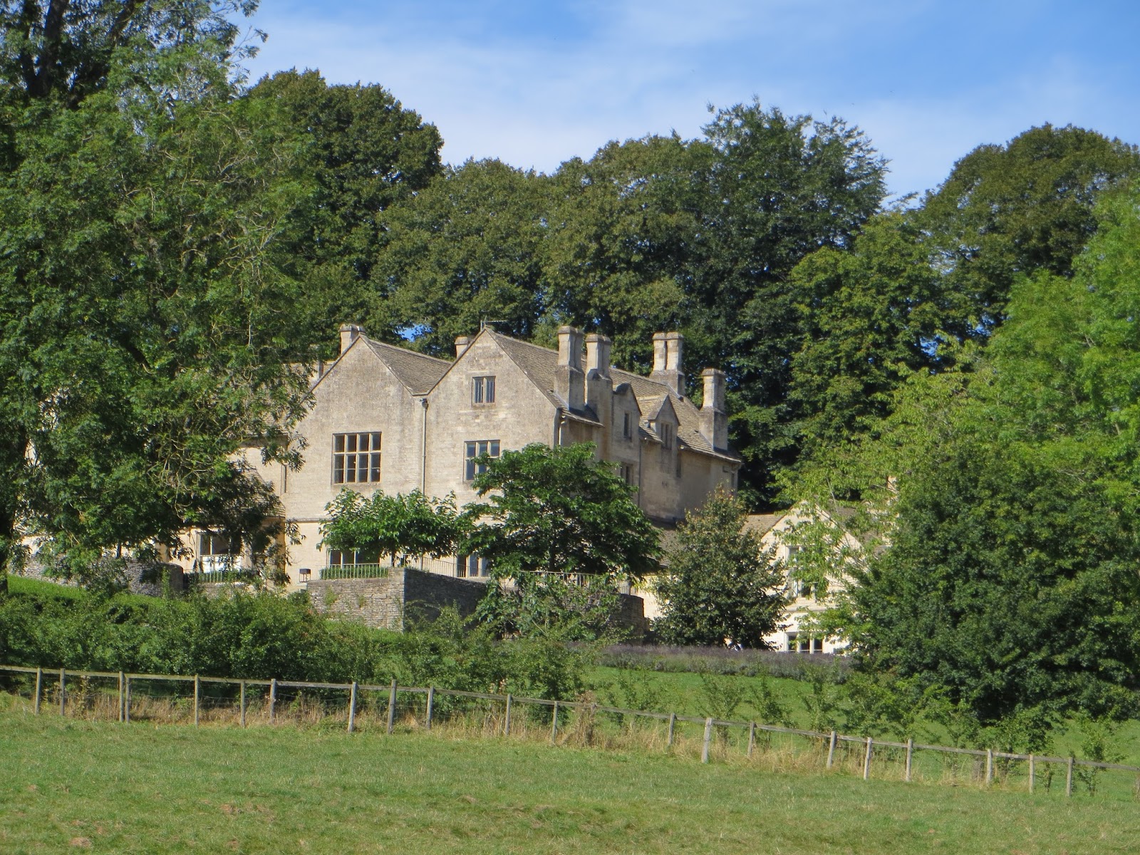
Distant view of Greys Court

Greys Court - National Trust property
T met P in Sonning Common and headed to Greys Court where we parked in the National Trust car park (Grid reference SU7268 8350).


See https://www.nationaltrust.org.uk/greys-court for more details. It looked like it was going to be a fine sunny day as we walked past the house and down to Rocky Lane.  We then turned south to Greys Green and after a short while left the road to drop down the slope and join a footpath towards Henley. Good views of Greys Court from the path as it headed east.

Stile of graffiti
Several stiles bore witness to the recent European Referendum with graffiti urging a vote to leave the EU. We wondered who had written these with their black felt-tip pens. Who were they aimed at? Walkers without a doubt, dog-walkers highly probably. We were left with the impression of geriatric dog-walkers roaming south Oxfordshire despoiling the countryside with anti-European slogans. Hey ho.


Pack & Prime countryside

We moved into woodland near Lower Hearnes and eventually joined the Pack and Prime Lane. This passed the Rotherfield site of Henley College (sixth-form). We had made good time to Henley-on-Thames but as it was now warming up we decided to pop into a pub for a quick drink. The first pub, The Row Barge Inn, was open, with the lights on but was not yet ready to serve being only 11:40! 


So we went down to the market place and popped into the Albion pub (6 out of 10) which was offering a “Midsummer  Ale “ in recognition that locations in south Oxfordshire and Buckinghamshire are used in ITV's "Midsummer Murders." At £4.50 a pint we restricted it to one drink but it was welcome nevertheless as it was now hot and sunny. 


Badgemore Golfers
The route from Henley skirted the housing estate below Friar Park and eventually come out to cross over Badgemore Golf course. The path was fairly well marked across the course. Quite a few gents playing golf, but no ladies in sight. The path then went into typical Chiltern beech woodland (Lambridge Wood). We found a sunny spot to have our lunch and then crossed over the lane to Bix before heading back into the Greys Court estate. A pleasant and gentle, half-day walk of 5.9 miles.


Dorchester-on-Thames – Friday 29 July 2016


Met up at P's home and drove to Wittenham Clumps, (Grid reference SU5674 9237). Another fine and warm day.  We decide to keep the walk short as T was having knee trouble again. We skirted Castle Hill and down into Little Wittenham Wood and then to the hamlet of Little Wittenham to cross the River Thames at Day's Lock, (SU5683 9347). This used to be the site of the annual Pooh Sticks competition, but no more. We pressed onto Dorchester via the ancient Dyke Hills and found the village via the allotments. Another warm day so dropped into the Fleur-De-Lys Inn (7 out of 10) for a rest and drink. Refreshed and limbs rested we returned by heading south towards the river found a great spot on the river bank for packed-lunch time. After a rest we walked round to Day's Lock again and plodded up the hill to get great views towards Oxford and Abingdon. It was then a short walk back to the car park and return to P's house for a welcome cup of tea. Not so far today, 4.5 miles and no pictures, sorry!


Woodcote – Friday 5 August 2016


It was T's turn to plan the walk so we selected another circular route this time around Woodcote. We met up at Woodcote Village Hall, (Grid reference SU6456 8207). We had a guest walker with us, T's partner Cy joined us for the first time. The route took us down Beech Lane to the west of the village and then turned up across the fields above Cleeve. There was a great view towards the Berkshire Downs and over the Vale of the White Horse.
Battle Road valley - Berkshire Downs beyond

The path then dropped down to Battle Road and Elvendon Priory. This was a rather posh establishment with electric gates and smart fences and according to the book not as old as it looked.
Elvendon Priory

Up the other side of the valley to emerge at Park Farm on the B4526, (road between Cray's Pond and Goring). We walked down this road for about 200m and then turned south to skirt Great Chalk Wood with the sound of shot guns from time to time punctuating the peace of the cool woodland.

 The path followed a dry valley through the woods and eventually came out at Blackbird's Bottom and crossed the road that goes down to Whitchuch and Pangbourne. The path then headed NE across what the book claimed was part of the old open common land, it looked rather too manicured to our eyes. 

Thistles
Crossed the B4526 again to the east of Cray's Pond and found ourselves in another large beech wood. Time for lunch and we found a reasonably convenient fallen tree to sit upon and partake of rolls/sandwiches and pork pie. The path came out by a converted chapel in the outskirts of Woodcote and we then made our way to Greenmoor Hill (SU6480 8122). At 184m AOD this is the highest point around and offered great views out to the East and South East. In the distance were some hills that we decided must be the North Downs near Dorking. Later research by P confirmed that this was more than likely. We were really stunned that we would get such a view. No wonder there is a communications tower here.

Another half mile, passing some 1970's housing estates and then across the playing fields and we were back to the cars. A really pleasant walk, with unexpected views and a different dynamic with Cy joining in the discussion of Brexit, Corbyn, etc.  Overall this circular walk was 5.5 miles, just as the book said.

View from Greenmoor Hill towards the North Downs


Upton and Blewbury – Friday 12 August 2016


Blewbury Cottage


Another fine day, rendezvoused at P's house and drove to Blewbury. Parked near the church (Grid Reference SU5314 8588).  Took a straight path across the fields to Upton through the village and across the A417 to follow the Lynch Way up onto the Berkshire Downs (the old name as we were actually in Oxfordshire!)


Line of the railway
The track runs parallel to the line of the railway that used to connect Didcot to Newbury. The line of the dismantled railway uses a cut through the Downs that some geomorphology books claim was cut by the overflow to a melt water lake formed at the end of the last ice age (jury is still out on that as evidence of lake shore deposits are needed to confirm the existence of an ancient lake).  We followed a well-made track through Prospect Farm and crossed the line of the old railway at Chilton Waste Transfer Station, SU4973 8470. Rather smelly and dusty so we quickly headed first south-west and then south-east and crossed the old line again just south of Churn farm.

Dismantled railway at Churn Farm
Wheat, wheat nothing but wheat (attrib. Woody Allen)
Further down that railway was the site of a station used to serve the Army barracks and training grounds that had been established here during the First World War.  We took our lunch up on the shoulder of Churn Hill enjoying the views across endless (apparently) wheat fields. The path carried on along the side of Churn Hill with views of Didcot Power Station now minus the old power house. (During the planned demolition of the power station half the power house collapsed killing several demolition workers. The remaining portion had recently been taken down by robots and explosives).

Flowers above Blewbury
Just above Blewbury there was a “useful bench” (SU5230 8503) that afforded a convenient resting spot and views across the Vale to the Chiltern Hills.

 A steep descent through wild flowers and eventually we came out on the A417 in Blewbury village.

Even the walls are thatched in Blewbury
Had this been a shop?
Stopped to take several photos of attractive buildings, thatched cottages and thatched “Cobb” walls and then found P's car back at the church.


This was a round trip of 7.1 miles. That's good, we are in shape to tackle the Cross-Cotswold again.