Culham circular - 2 May 2017
P & T agreed to meet up to keep the limbs in some sort
of working order. P suggested a walk around some local villages, known by name
but never really seen; those places that are now by-passed and are only ever
noted on the local sign posts. The weather looked promising, not too hot a
typical spring day.
 |
| St Helen's church and wharf, Abingdon |
We parked up at the car park near Culham Lock Grid Ref:
SU5084 9493 and walked up through the village of Culham. This is a small
village strung out along one central road and by-passed many years ago by the
A415. There used to be two pubs, The Lion, a Morrell’s establishment, adjacent
to what passed for the village green and the Wagon and Horses (Morland’s) up on
the main road. Both closed some years ago. The Lion (SU5034 9504) is now a
private house which suits the architecture as the building when it was a pub
always looked rather incongruous as a dark brick rectangular edifice. We walked
down beside the old pub and reached the River Thames, actually the navigation
channel, “Culham Cut” and turned upstream to follow the Thames Path to
Abingdon.
This was T's old stamping ground and he was able to recount
stories of teenage fishing trips and school rambles along this part of the
Thames. We passed several walkers going the other way, perhaps Thames Path walkers
setting off from their overnight stay in Abingdon. As we neared Abingdon there were more dog
walkers and several off-peak boaters taking their morning walks before
returning to their rented boats for coffee and a browse through the papers.
This is an excellent way to approach Abingdon with the
church of St Helen's (SU4969 9677) and the old river wharf framing the view.
Abingdon used to be where the Wilts and Berks canal joined the Thames. The
canal, like many 18th century navigations, never amounted to much
and was finally put out of business by Brunel’s GWR railway that deliberately
followed the canal for some of its route. Anyhow one remnant of the canal is
the bridge over the River Ock that the canal company built to access their
canal pound.
 |
| Wilts & Berks bridge |
Up to Abingdon bridge, past the recently renovated (again)
old county gaol, (or as famously referred to on BBC Radio Oxford “The Old
Goal”) past the old County Police Station and into the market place dominated
by the old County Hall. You have probably got the message that Abingdon used to
be the county town of Berkshire but lost that accolade to Reading when the good
burghers of Abingdon refused to have the new railway. Brunel had already
started his HQ buildings at Steventon (half way between Bristol and London) and
wanted to take his railway north through Abingdon to Oxford. Brunel was not deterred
and built the junction at Didcot. Eventually the town folk of Abingdon realised
their mistake and had a silly branch line built to Radley. That closed many years
ago. Sorry for the potted history lesson.
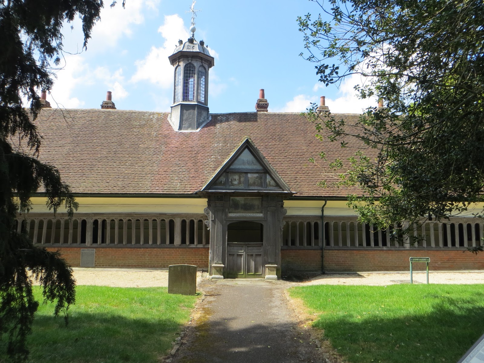 |
| Long Alley Almshouses, St Helen's, Abingdon |
The path then headed south from New Cut Mill (SU4795 96190 - line
of the old canal again) and then due south towards Drayton. The path slowly
climbed upto Sutton Wick and there were reasonable views of Abingdon and its
1970s housing estates.
Sutton Wick, Drayton, was quiet and neat with various farm
barn conversions. The footpath cut through from this hamlet to the village
proper. This was the old part of Drayton which is not on the normal rat-run.
Our path took us round the allotments, past the back of St Peters church and eventually
across the B4016. It was time for lunch so we stopped at a foot bridge over a
strongly flowing stream, (SU4844 9398). The water looked a bit dodgy and later
investigation showed that it was the effluent from the sewage works between
Drayton and Milton.
After our brief stop we headed towards Sutton Courtenay
along the Drayton East Way. This is a large village strung out between the
newer part in the south and the ancient village around the church. Sutton
Courtenay also used to boast several pubs and now most of them are closed and
converted.
Following first publication of this post our walking colleague A added the following information about the church in Sutton Courtenay.
George Orwell is buried in the churchyard of All Saints' Church, Sutton Courtenay in a rather humble grave as Eric Arthur Blair. Apparently he had no connection with the village but wanted to be buried in an English village and his friend David Astor, the publisher (son of Lady Astor, thus linked to David Cameron!) arranged it. In addition to Eric Blair and David Astor the other notable person buried in the churchyard is the Prime Minister Herbert Henry Asquith.
We detoured around the recreation ground and the back lanes and eventually came out at the George and Dragon (one of the remaining pubs), SU50494227 . We seemed to be the only people there and despite being a lovely spring day there was a fire in the grate. A welcome drink, we were quite thirsty, and then off to complete the walk by walking round the weirs at Sutton Pools and past rather quaint cottages and smart homes backing onto this back water. We came out at the new hydro power station (SU5019 9437) though couldn't tell what sort it was as it was all secure behind blank walls and steel doors.
 |
| Sutton Courtenay - a backwater |
Our path went across the flood plain and up to the Culham
Cut again and then to Culham Lock to collect the car and return to P's for a
welcome cuppa.
Well that was good, 9.1 miles in just over four hours.
Really great to discover or rediscover these villages. Sorry about the local
history lecture. We feel ready to tackle the next Cross-Cotswold.
No comments:
Post a Comment